Greenpeace has placed giant boulders inside a protected area of the North Sea, using physical obstacles to challenge bottom trawling. Announced on 2 November 2026, the action raises a question that extends beyond this particular stretch of water: what does marine protection mean when fishing gear can still be dragged across the seabed?
Quick Answer
Greenpeace has placed boulders weighing up to two tonnes in the Southern North Sea Marine Protected Area to deter bottom trawling. The organisation says the barrier protects 116 square kilometres. UK authorities have published the reported boulder positions, but the action does not create a legal fishing ban.
What happened in the North Sea?
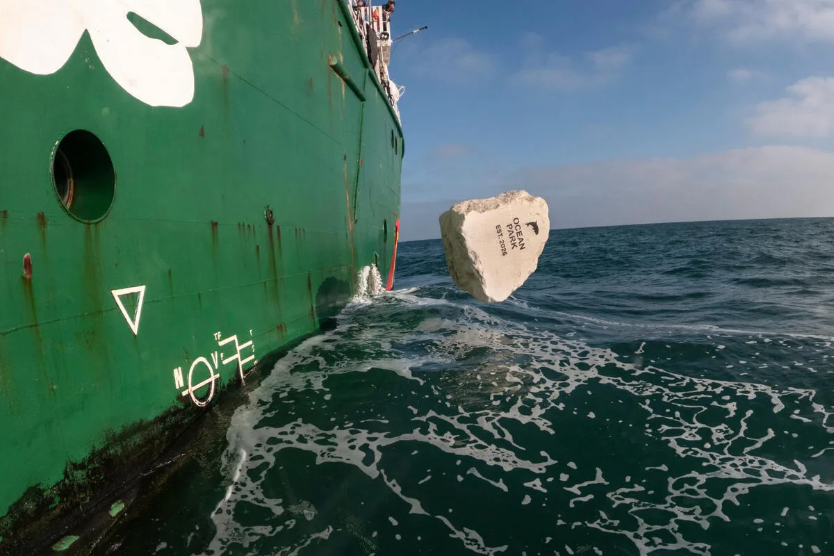
Campaigners aboard the Arctic Sunrise placed the boulders off England’s east coast. Greenpeace describes the intervention as an “Ocean Park” and says it will deter fishing vessels from towing equipment through the targeted area.
The organisation estimates that bottom-towed fishing activity in the wider protected area reached at least 37,200 hours in 2025, based on its analysis of Global Fishing Watch data. These figures and the claimed extent of the barrier’s protection come from Greenpeace, rather than an independent assessment of the intervention.
Why is this area protected?
The Southern North Sea is a Special Area of Conservation designated in February 2019 for harbour porpoises. According to the UK’s Joint Nature Conservation Committee, it covers approximately 36,951 square kilometres and includes important seasonal habitat for the species.
Its conservation objectives include preventing significant disturbance and maintaining supporting habitats and prey availability. Protection therefore concerns the conditions porpoises depend on, as well as the animals themselves.
The site’s size also provides context: the area Greenpeace says it has shielded is only a small part of the wider conservation area.
INFO BOX — Protected does not automatically mean no fishing
A marine protected area is not necessarily a no-take reserve. Restrictions depend on its conservation objectives and management rules. JNCC identifies existing bottom-towed gear restrictions in parts of the Southern North Sea site that overlap with other protected areas.
How do boulder barriers work?
Bottom trawling involves towing fishing equipment along the seabed. Large rocks can obstruct that equipment, making a route difficult or hazardous to fish. Greenpeace uses this physical deterrent to discourage seabed-contact fishing in selected locations.
The distinction matters: a seabed obstacle cannot exclude every fishing method. Nor does placing boulders demonstrate, by itself, that an ecosystem has recovered. Assessing that would require monitoring over time.
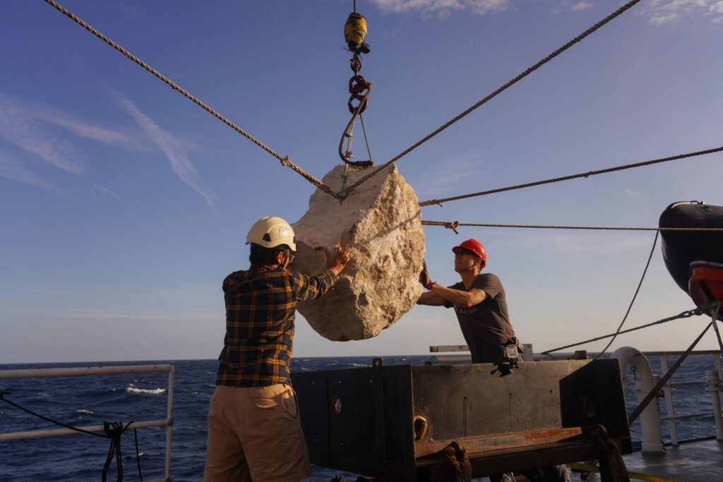
Greenpeace places a boulder in the Southern North Sea during its campaign against bottom trawling in protected waters.
What have the authorities said?
On 2 November, the Marine Management Organisation published nine reported boulder positions supplied by Greenpeace through HM Coastguard. The regulator advised fishing vessels and other sea users to account for them when planning their activities, while noting that it had not independently verified every position.
Previous interventions have faced regulatory objections. In 2022, the MMO criticised Greenpeace’s South West Deeps action, questioned its likely benefit and said the deposits required marine licences. Those objections concerned that earlier operation; they should not be presented as a new ruling on the November 2026 action.
Part of a wider campaign
Greenpeace previously placed boulders at Dogger Bank in 2020, Offshore Brighton in 2021 and South West Deeps in 2022. In May 2025, it also placed 15 limestone boulders in the Gulf of Lion Marine Park off France.
The latest operation combines a local physical intervention with a broader political demand: stronger restrictions on destructive fishing inside protected waters. Whether it delivers lasting ecological benefits will depend on what happens after the boulders reach the seabed.